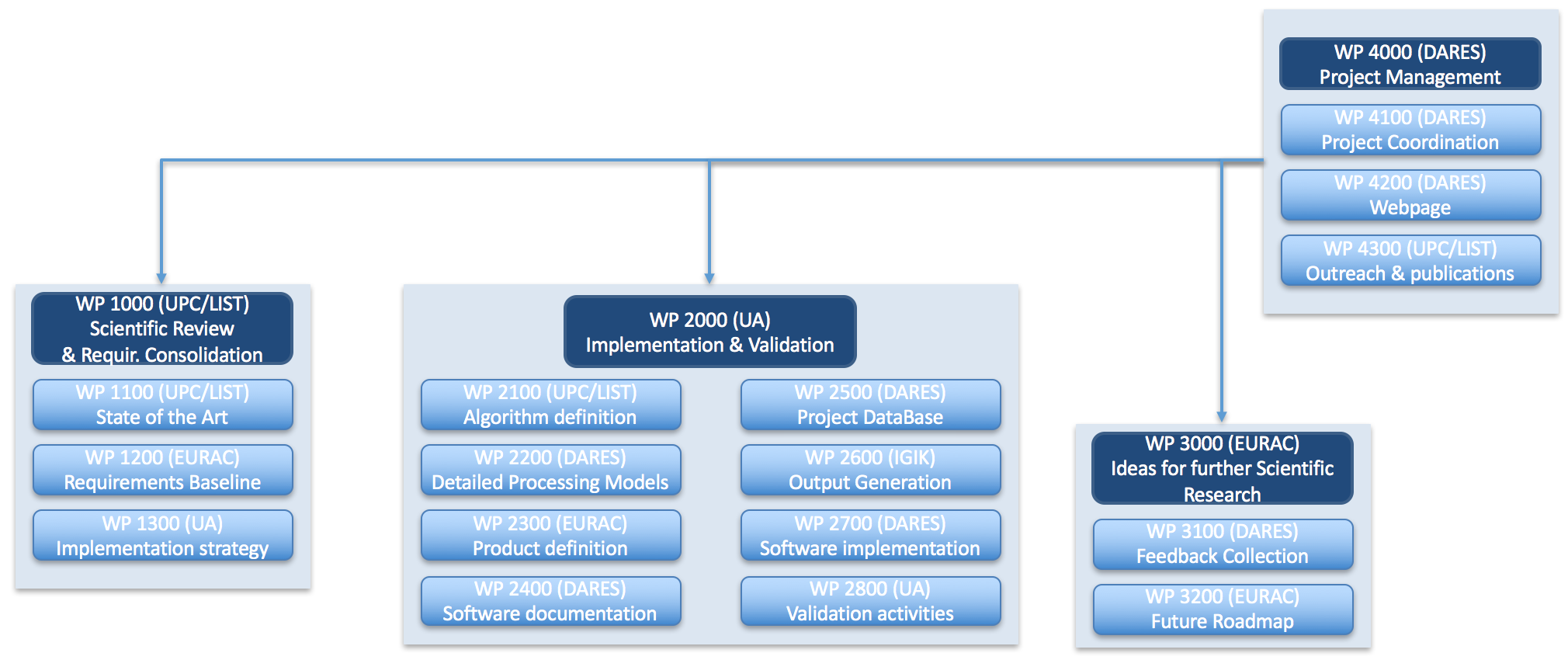
Workpackage structure
The project plan is organized in four phases, related to the main Work Packages:
A eighteen-month phase for the services Implementation and Validation (WP2000)
A three-month phase for the Recommendations for further Scientific Research (WP3000)
And the project management task that extend over the whole project duration (WP4000)
Round Robin Consultation
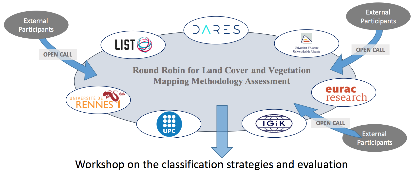
In order to increase the value of the output of this scientific project the consortium has devised a Round Robin (RR) consultation which is intended to empower the value of any extracted conclusion. The consultation is oriented to the team-members of the project consortium but external participants are also encouraged to participate. Please, contact us in case you are interested.
The objective of this consultation is to compare in a fair way alternative strategies of land cover classification based on the same stack of SAR data. For this purpose, the consortium will provide access to an already-existing stack of pre-processed Sentinel-1 data. All the RR participants (consortium partners and external participants) should provide, in addition to the classified results, a detailed description of the followed methodology. After the consultation period of four months, the classification results of each team will be assessed and presented in a specifically-devised workshop. All the participants will be encouraged to attend this meeting. The outcomes are planned to be published in distinguished journals and conferences.
RR Planning
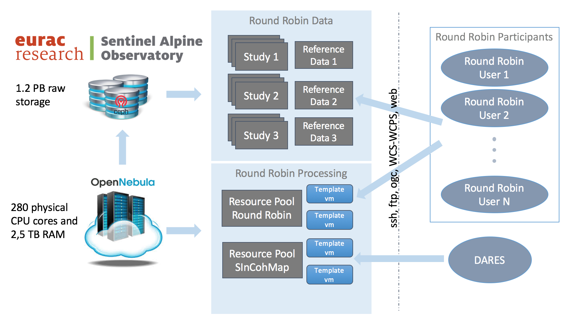
The round robin period is scheduled to begin with the data dissemination to all its participants. Sentinel-1 data from three sites at different locations are currently being pre-processed and will be made available to every team. Each site consists of an area of approximately 20 x 20 km containing a variety of classes (agricultural crop fields, forest, urban, wetlands, etc.) Radiometric, interferometric and polarimetric data spanning 2 years have been considered for each site.

RR Access structure
All the information will be provided already co-registered and transformed into geographical coordinates. Remote access to the data will be granted through different services. Although the final mechanisms still have to be decided, at least a ssh solution will be established.